Drainage, slope protection and access road support for projects
Road and infrastructure projects often face difficult terrain, including wadis, steep mountain cuts, rocky slopes, erosion-prone ground and remote access corridors. These conditions require proper drainage planning, slope protection, rockfall control and terrain-based engineering decisions before and during construction.
Cenpace supports owners, EPCs, consultants, developers and contractors with road drainage assessment, wadi crossing inputs, access road engineering support, slope stabilization recommendations, erosion control measures and mountain terrain protection studies.
Our work combines UAV survey, RTK/GNSS survey, hydrological analysis, terrain assessment, slope condition review and engineering reporting to support feasibility, design, construction and post-event damage assessment.
What we deliver
Drainage and wadi crossing support
✓
Road drainage assessment
✓
Catchment delineation for drainage points
✓
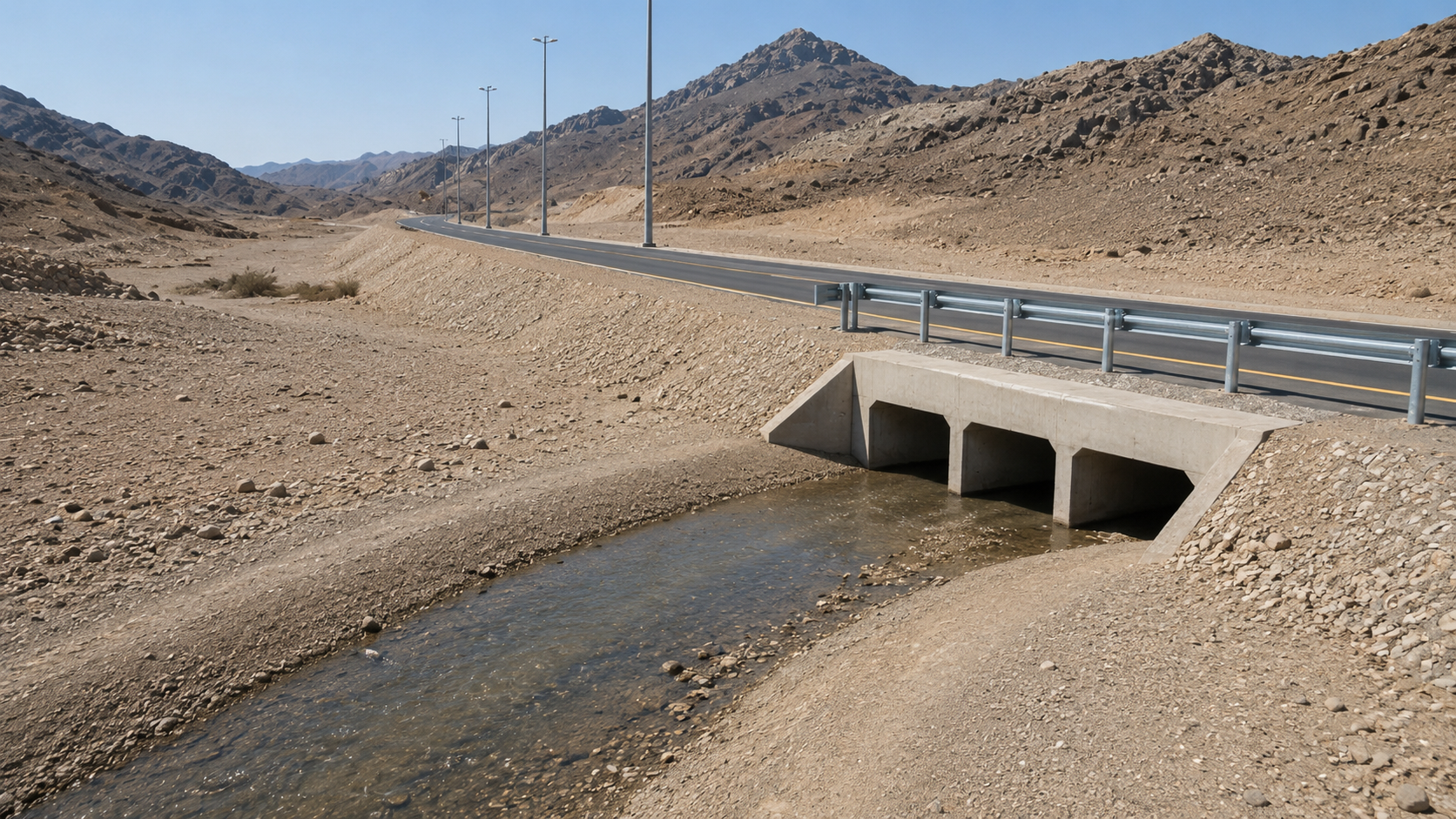
Wadi crossing assessment
✓
Peak flow estimates for required return periods
✓
Culvert sizing inputs and hydraulic basis
✓
Stormwater flow path mapping
✓
Roadside drain and channel assessment
✓
Flood exposure and drainage damage assessment
Slope stabilization and mountain protection
✓
Visual slope condition assessment
✓
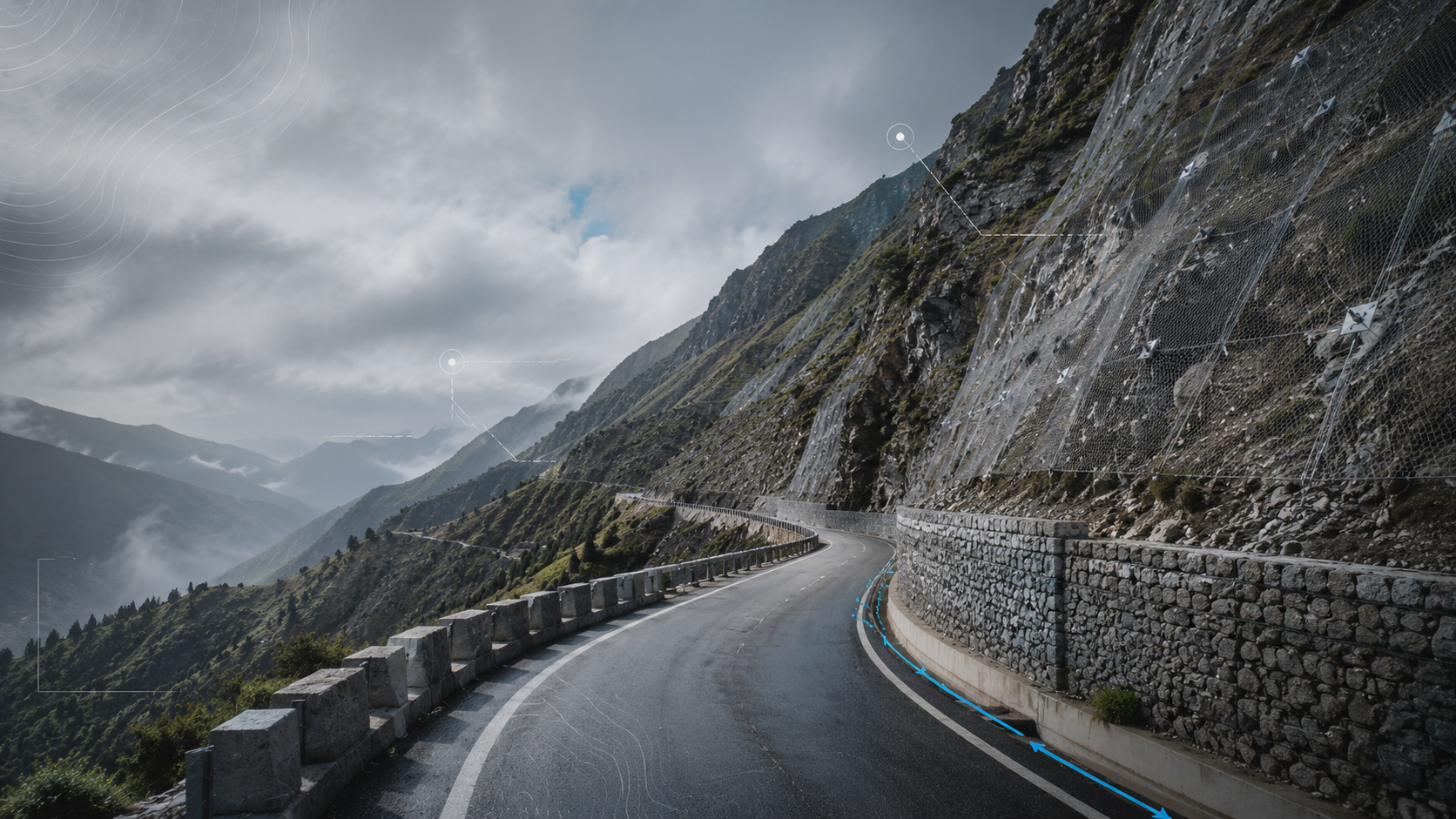
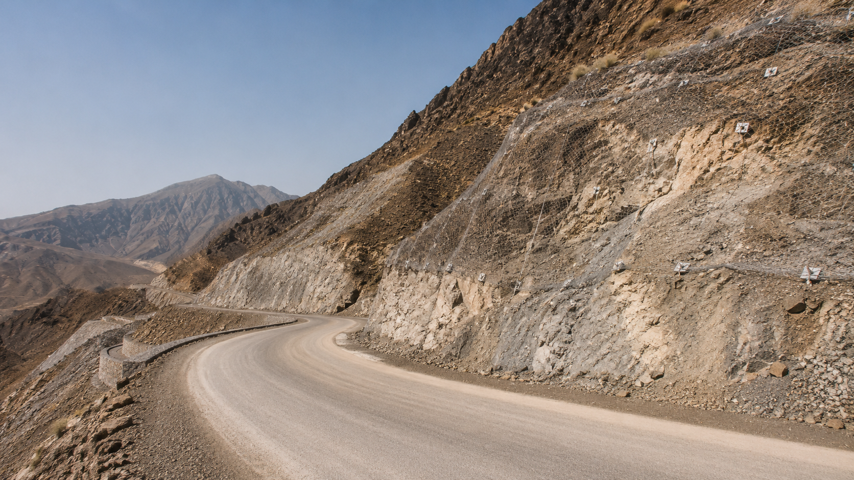
Mountain cut slope assessment
✓
Rockfall hazard identification
✓
Rockfall protection recommendations
✓
Slope protection design inputs
✓
Retaining wall and gabion wall inputs
✓
Rock bolt, anchor bolt, mesh and shotcrete concept inputs
Access road and infrastructure support
✓
Access road alignment review
✓
Road corridor topographic survey
✓
UAV orthomosaic and DTM preparation
✓
Cut and fill quantity support
✓
Road gradient and terrain constraint review
✓
Construction access road planning support
✓
Pipeline and utility corridor access review
✓
Road corridor GIS layers and CAD outputs
Engineering reporting and deliverables
✓
Engineering support report
✓
Drainage and slope protection recommendations
✓
GIS mapping and CAD drawings
✓
Annotated site observations
✓
Design basis inputs for consultants and EPCs
✓
Protection measure sketches where required
✓
Priority action list for high-risk areas
✓
Construction-stage review support
Where this support is used
Highways and main roads
Local and internal roads
Mountain roads
Wadi crossings
Access roads
Temporary construction roads
Transmission line access routes
Mining and quarry roads
Culverts and drainage channels
Slope protection areas
Rockfall-prone zones
Post-flood road damage areas
Service approach
01
Site review and data collection
Project location, corridor alignment, drainage points, slope sections, access constraints and available drawings are reviewed. UAV or RTK/GNSS survey is planned where required.
02
Corridor survey and terrain mapping
Road corridor, wadi crossings, cut slopes, drainage paths and terrain features are mapped using UAV survey, RTK/GNSS survey and GIS analysis.
03
Drainage and hydrology assessment
Catchments are delineated, peak flows are estimated and drainage paths are assessed. Culvert inputs, roadside drainage requirements and flood exposure areas are identified.
04
Slope and protection assessment
Mountain cuts, unstable slopes, erosion areas and rockfall-prone sections are reviewed. Protection options such as rock bolts, anchor bolts, mesh, shotcrete, gabions, retaining structures and geogrid reinforcement can be considered at concept or input level.
05
Engineering support report
A structured report is delivered with survey outputs, drainage inputs, slope observations, protection recommendations, GIS/CAD deliverables and priority actions for design or construction teams.
Relevant experience
 Slope & Terrain Assessment
Mountain Road Cut Slope Assessment
Scope
Road corridor survey, mountain cut slope condition review, rockfall hazard identification, erosion mapping and drainage catchment assessment for a remote access road in rugged terrain.
 Access Road Engineering
Road Drainage Assessment
Scope
Drainage catchment mapping, wadi crossing assessment, peak flow estimates, culvert sizing inputs and stormwater flow path review for a road corridor.